Streambed serves as scenic trail through Hackberry Canyon, Utah
Hackberry Canyon lies in the southern part of Grand Staircase-Escalante National Monument in Utah. The long drive pays off in endless solitude, stunning scenery and a streambed hike.
A day hike at Hackberry Canyon can take you as far upstream as you’re comfortable with before returning to the trailhead. For those seeking more adventure, a multiple-day backpack trek can take you through the entire 20-mile canyon. For this, you’ll need a permit, some technical climbing skills for the upper reaches and two vehicles for shuttling. The through hike starts at Round Valley Draw on the north part of Cottonwood Canyon Road.
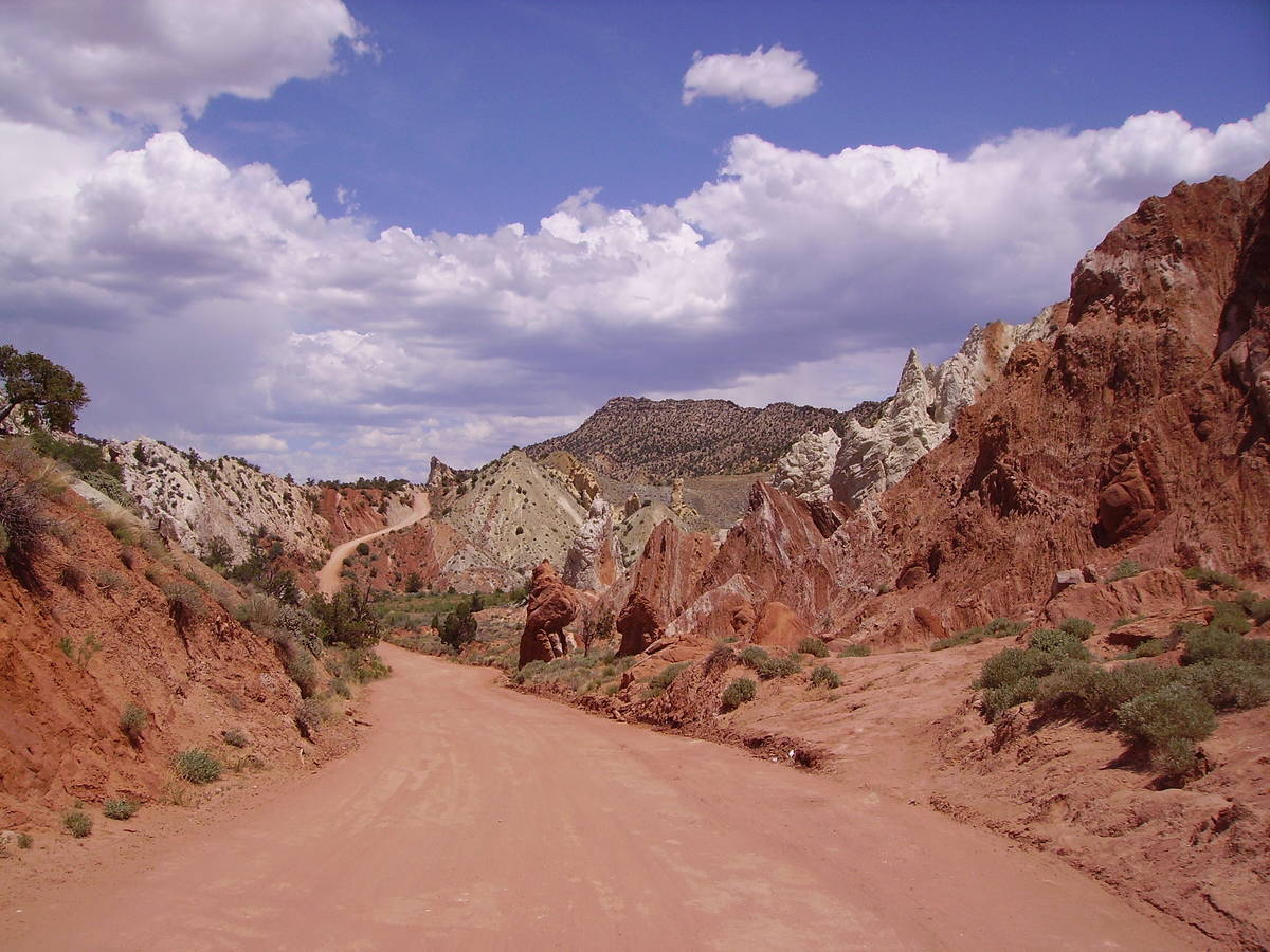
Just driving to the trailhead is worth the trip. Once off U.S. Highway 89 (the route from Kanab, Utah, to Page, Arizona), the gravel and clay Cottonwood Canyon Road begins.
This scenic route starts in a barren landscape of badlands. The road then heads northwest to the eastern banks of the Paria River. The stream is wide and open here, unlike the narrow stretch in Paria Canyon downstream on the Arizona Strip.
As you continue north on Cottonwood Canyon Road toward the trailhead, the Paria River heads out of sight to the northwest, but Cottonwood Wash continues along the road. Here you will be at the base of the Cockscomb, a segment of the east Kaibab monocline, which runs from the Grand Canyon north near Bryce Canyon. After about 14 miles from U.S. 89, you will see a sign for the parking turnoff.
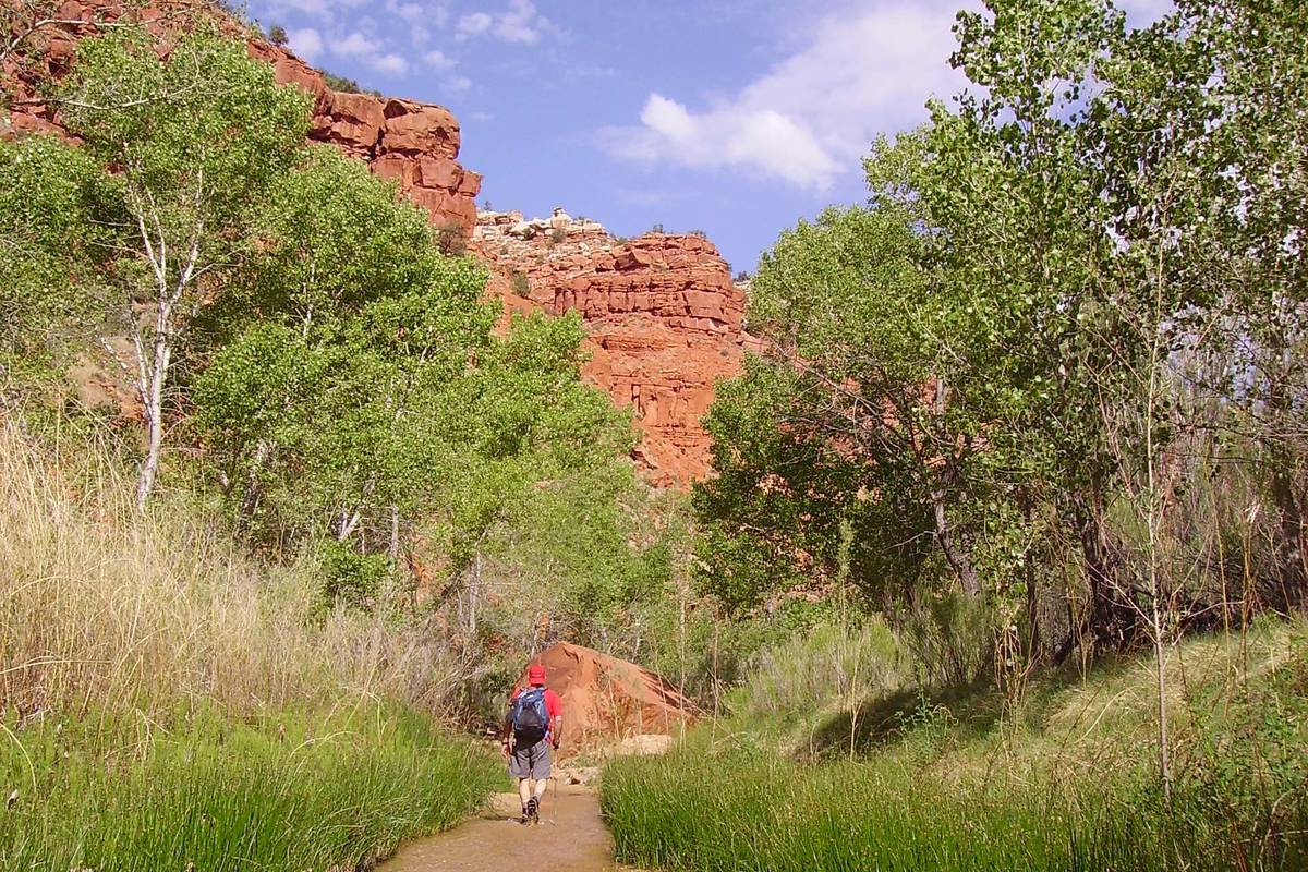
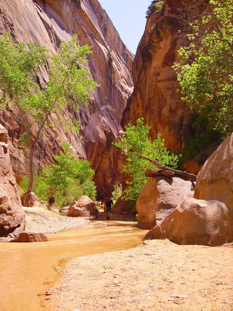
From the parking area and trailhead, located at an elevation of 4,775 feet, trek down the small embankment and into Cottonwood Wash. Head northwest across this wash and on to another wash, which serves as the mouth of Hackberry Canyon. Usually, this wash will be dry for the first quarter mile or so, then you’ll see a ribbon of water and soon the entire sandy streambed will have a couple of inches of water.
This water trail makes for easy traveling, though in spots you will hike on obvious paths through the horsetails to avoid boulders.
The first 2 miles of the canyon contain the most stunning scenery of high cliff walls of red, orange and pink Navajo and Kayenta sandstone. In some areas, the cliffs are just 20 feet apart. Plants grow in the nooks and crannies of the sandstone walls. Lush riparian growth of cottonwood, box elder and seep willow populate the canyon floors, with horsetails flanking the streambed. This time of year, there is often a good wildflower show with penstemon, globe mallow and paintbrush in bloom.
Hackberry Canyon has side canyons worth exploring. One is Sam Pollock Canyon. As with other side canyons, the terrain is rocky and full of boulders, so you’ll have to do some scrambling.
To access Pollock Canyon, travel up Hackberry a bit less than 3 miles from the trailhead and go left into an obvious canyon. After about half a mile, you will come to a dry fall that blocks further progress. Backtrack about 100 yards and head up the canyon along the faint path on the north side of the trail. This takes you around the obstacle and then returns you to the canyon floor where you will hike a mile farther and find an arch on the right. The arch was named after Pollock (1885-1965), who grazed cattle here and was a Garfield County commissioner.
Free-roaming cattle frequent Cottonwood Canyon Road and the trailhead area. Never attempt to drive the road or hike Hackberry Canyon if it has been raining or if rain threatens. The canyon is prone to flash flooding and the road becomes impassable. Even in good weather, you will need a high-clearance vehicle, preferably four-wheel drive, with good off-road tires. This destination is particularly good for the next month or so, and again in fall.
Travelers heading from Las Vegas to Kanab can get weather reports and maps at the Kanab Visitor Center, 745 E. Highway 89.
The center’s current hours are 8:30 a.m. to 4 p.m. Tuesdays through Saturdays but are subject to change. Call 435-644-1300 or visit blm.gov (click on Utah, scroll to Grand Staircase-Escalante National Monument) for additional information.
Many of Deborah Wall’s columns have been compiled into books about hiking in the Southwest. She is also the author of “Great Hikes, a Cerca Country Guide” and a co-author of the book “Access For All, Seeing the Southwest With Limited Mobility.” Wall can be reached at Deborabus@aol.com.
Directions:
From Boulder City, take Interstate 11 north and merge onto U.S. Highway 95 north. Continue until Interstate 15 and head north about 15o miles to Utah State Route 9 East/West State Street in Washington. Take exit 16 to Utah State Route 59 south and Arizona State Route 389 East to U.S. Highway 89 South in Kane County, traveling 86 miles until you reach Grand Staircase-Escalante National Monument.


