Varied geology, history evident throughout Death Valley


You could spend months or even years exploring Death Valley National Park in California and never see it all, but for first-time visitors even a day trip can be more than satisfying, and now is a good time to do it.
The best plan for a day trip is to head first to the hub of the park, the Furnace Creek area, and travel out from there. Begin your trip by stopping at the Furnace Creek Visitor Center. Here you can pay an entrance fee, pick up a free map and a visitor guide and get any updates on road and weather conditions.
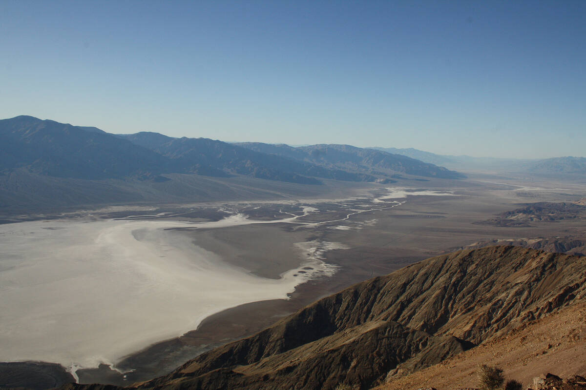
From the visitor center, drive south 1.2 miles and then veer right onto California 178 (Badwater Road). This flanks the base of the Amargosa Mountain Range on your left (east) and the Badwater Basin on your right (west). Drive about 17 miles to the parking area at Badwater Basin.
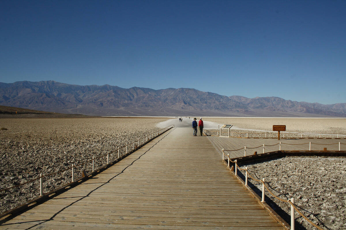
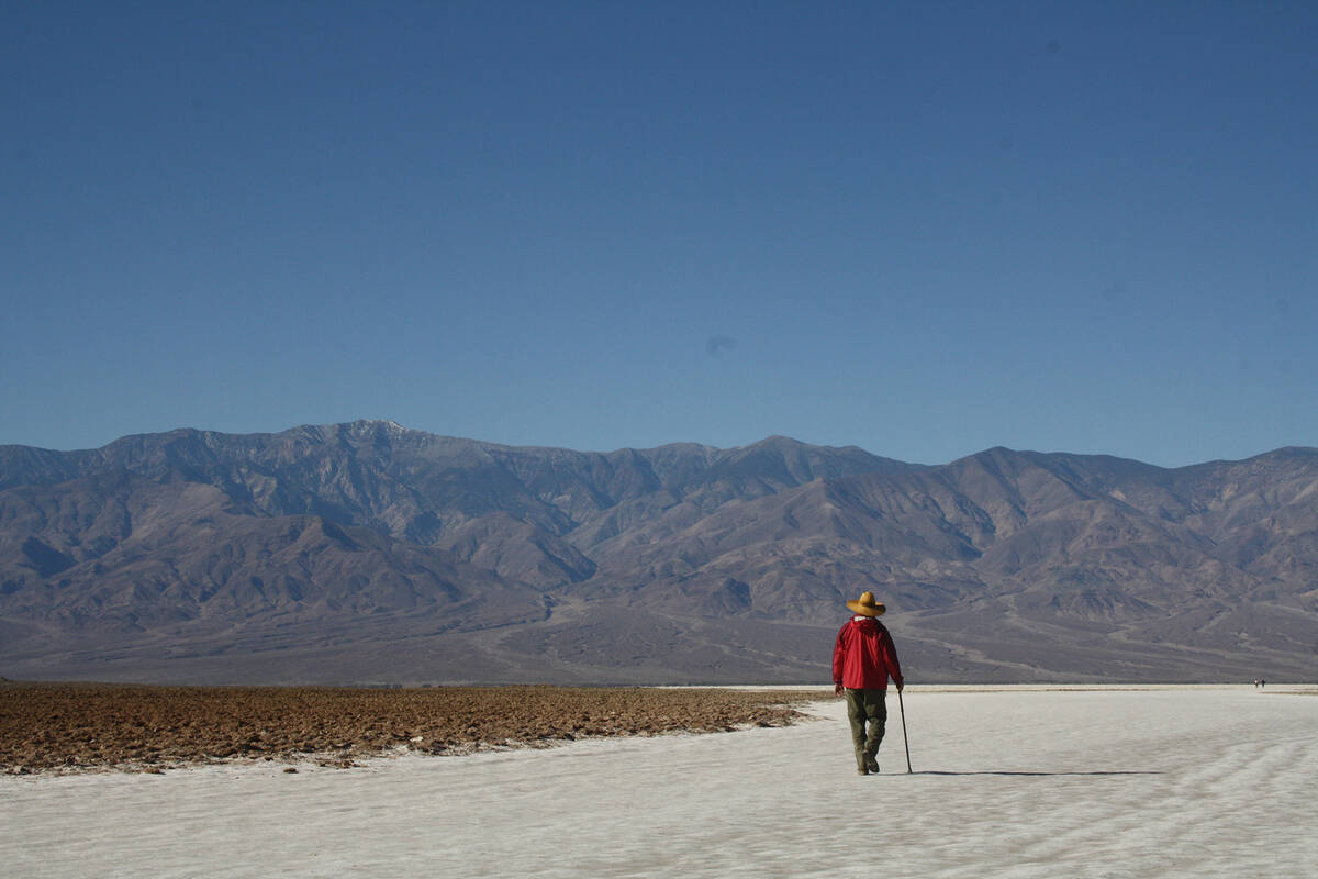
The main attraction at Badwater Basin is you will be standing 282 feet below sea level, the lowest point in the United States. Furthermore, all ages and abilities love to begin a short hike here. First head out on the wood boardwalk, and then onto the salt pan itself. The wide open path has been flattened down by foot traffic and looks like snow. In cooler months the sun still warms this path, but only to temperatures tolerable to tender toes. Our family tradition here is to walk barefoot a short way, feeling the pleasant sensation, as if walking on warm snow.
You can walk as far out as you feel comfortable and may be in for a rare treat if it has rained recently, for water sometimes collects. In at least one year of living memory there was enough that some kayaked it, but more often there is barely enough to wet the toes.
If you travel out about a quarter mile the terrain starts getting pretty rough and you’ll find large polygonal salt formations, quite interesting to see, but they are difficult to walk on and have extremely sharp edges.
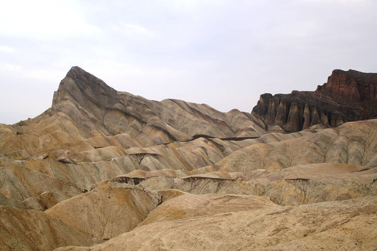
Looking across Badwater to the west you will see the Panamint Mountain Range and its highest peak, Telescope Peak; at 11,049 feet it is often capped with snow this time of year. This is quite a stunning disparity in elevation to be within eyesight from a single vantage point, and you will rarely or never experience its equal anywhere else.
On your return to the parking area, be sure to look across the road for a small sign that identifies sea level, quite dramatically, by its location so high on the cliff wall.
Leaving Badwater Basin and continuing your tour, drive north and go right at 3.8 miles. From here drive on a gravel road about 1.5 miles and park. Head out on foot for the easy, yet rocky, 1-mile round-trip leg stretcher to a natural bridge.
Returning to Badwater Road, drive another 4 miles and go right onto Artist’s Drive. This is a one-way paved road that undulates through 9 miles of some of the park’s most colorful scenery of multihued volcanic and sedimentary rocks. There are good places to stop along the way and the road eventually rejoins Badwater Road.
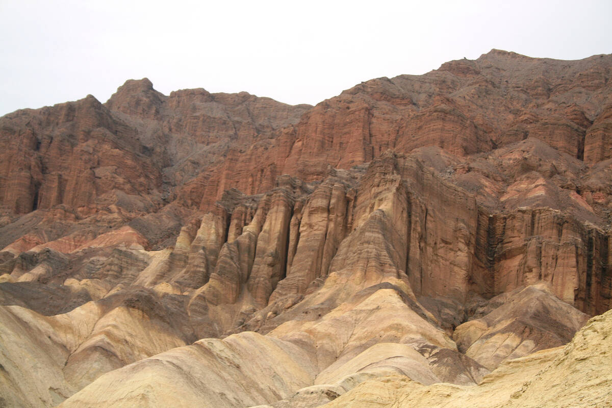
From the Artist’s Drive’s exit onto Badwater Road, you can drive about 3 miles north and you will find the parking area for Golden Canyon. Head out on foot for an easy 2-mile round-trip hike, with about 300 feet elevation gain, which takes you up Golden Canyon to see the geology including the highlight cliffs of Red Cathedral and a prominent outcropping named Manly Beacon after one of the men who rescued stranded Forty-Niners in the incident that gave Death Valley its ominous name.
There was once a road in this canyon. After repeated flash flooding, including a four-day storm in 1976 that took much of the road with it, the canyon roadbed was surrendered to Mother Nature. As in all canyons, stay out if rain threatens.
Much more has occurred here both in human history and geological. Before setting out for Golden Canyon, look at the visitor center or trailhead for the brochure, which delves more deeply into the canyon’s history.
The Furnace Creek area has gasoline, a market, restaurants and lodging, but they tend to be crowded and pricey so it’s better to fill up fuel tanks and family before leaving Nevada. The dry air dehydrates humans quickly, even in winter, so pack along a minimum of a gallon of water per day per person, and more in case you get stranded by car trouble, or charmed into staying longer than you had planned.
The least complicated route from Las Vegas is to take Blue Diamond Road (Nevada Highway 160) some 55 miles through Pahrump, and then turn left on Bell Vista Avenue, well marked with brown signs as the way to Death Valley National Park. After 26 miles (and a name change at the California border, to State Line Road) this leads to the interesting village of Death Valley Junction. Here you can take California Highway 190 to Furnace Creek. The whole drive usually takes about two and one-half hours but speed reductions and delays might be a factor due to current repair work on Highway 190.
The Death Valley Visitor Center is open daily from 8 a.m. to 5 p.m. and has bathrooms, pass sales, a bookstore, exhibits on the park and a park film. Detailed handouts on area trails and destinations are available.
For more information, including current mask mandates, contact 760-786-3200 or www.nps.gov/deva.
Many of Deborah Wall’s columns have been compiled into books about hiking in the Southwest. She is also the author of “Great Hikes, a Cerca Country Guide” and a co-author of the book “Access For All, Seeing the Southwest With Limited Mobility.” Wall can be reached at Deborabus@aol.com.
Directions:
From Boulder City, take Interstate 11 north to the 215 Beltway and head west to Blue Diamond Road (Nevada Highway 160). Continue for about 55 miles through Pahrump, and then turn left on Bell Vista Avenue. After 26 miles (and a name change at the California border to State Line Road), continue to California Highway 190, traveling west about 30 miles to Furnace Creek.