Trip to Banshee Canyon short but adventurous
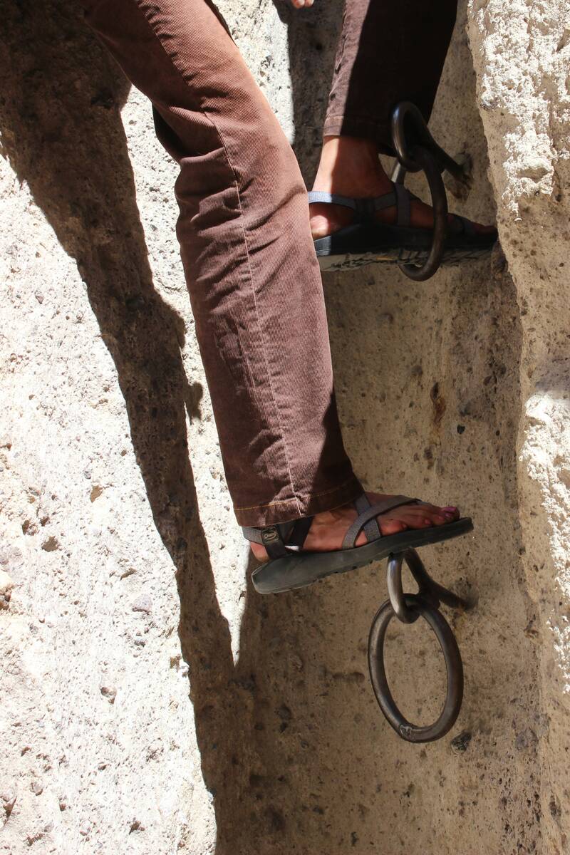
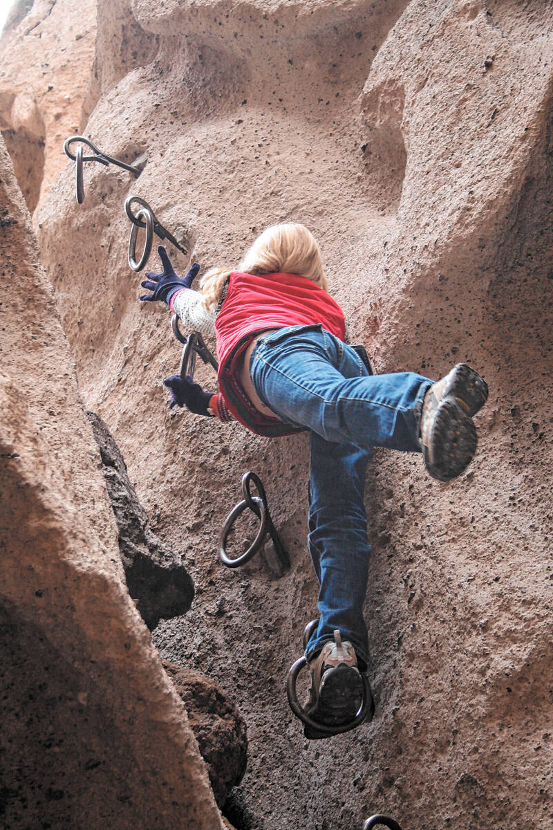
The Rings Trail to Banshee Canyon is a short but adventurous outing in California’s Mojave National Preserve. It offers the unique challenge of navigating a narrow slot canyon using ring bolts to aid you, on both the descent and the return.
Located in the Hole-in-the-Wall area of the park, the trailhead is less than a couple of hours’ drive from Boulder City, but once you’re off the highway and into this area of California, you’ll find remote territory and empty roads. The trailhead is 4,288 feet in elevation, so expect it to be about 10 to 15 degrees cooler than in the city.
From the parking area, walk behind the interpretive signs and follow the path, which is well-worn yet rock-strewn. In a minute you will reach the top of the slot canyon that takes you down to Banshee Canyon. It starts just after you reach a sharp left turn along the rocks and immediately becomes very steep and narrow. This will be the initial drop-off point and the beginning of the first set of ring bolts put in place by the Bureau of Land Management in the 1970s.
The easiest way to get started on the descent is to turn around and face the wall where the rings are located. Grab the first ring and lower yourself down, so one of your feet is firmly in a lower ring or atop one of the bolts anchoring each of the four rings. Then grab the next ring down and lower the other foot. Repeat until you are standing on firm ground.
The next section is longer, about 10 feet, with six ring bolts, but they are placed more conveniently, and people have stacked boulders to help your footing at the bottom. Keep in mind that the bolts were spaced for adults, so children will most likely need some help.
Once you are out of the slot section, walk out through the canyon walls where it opens considerably and you are in Banshee Canyon proper. Its formations can appear grotesque and spooky, and if the wind is blowing you will hear eerie noises suggesting the mourning wail of the banshee in Irish legends.
These formations resulted millions of years ago from volcanic eruptions. Where gas was trapped it created the holes, windows and other formations before you. With further natural erosion from wind and rain, the holes have enlarged and become a delight to explore, especially for children.
Hole-in-the-Wall is not the famous outlaw hangout that went by that name in the 19th century (that’s located in Wyoming’s Big Horn Mountains). But in the early 20th century, the region that is now the park saw bitter confrontations between small ranchers and a bigger cattle company. Local historians say one of the small operators resented being accused of rustling by his larger neighbor, so he named Hole-in-the-Wall after the famed outlaw den, thus rubbing the bigger outfit’s corporate nose in the reputation it had created for him.
Fill your gas tank before leaving Nevada and bring everything you will need for the day, such as water and food, spare tire and other emergency equipment, as there are no services in the park; even cellphones are unreliable. Two campgrounds are open, but because of wildfire danger, no open fires are allowed in the park at this time.
The Kelso Depot, a charming former train station preserved and adapted as a visitor center and museum, is currently closed because of a mechanical failure in its climate-control system, but Hole-in-the-Wall Information Center remains open on a limited basis, as staffing allows. Before your visit, be sure to look up the park website at www.nps.gov/moja and download a map for directions to the trailhead.
That’s also the place to find road conditions, the weather forecast and other alerts. Doing that is a good idea on any backroad adventure, but here it is imperative. This is not a good park to hike in or drive around in when rain threatens or immediately after a storm.
Many of Deborah Wall’s columns have been compiled into books about hiking in the Southwest. She is also the author of “Great Hikes, a Cerca Country Guide” and a co-author of the book “Access For All, Seeing the Southwest With Limited Mobility.” Wall can be reached at Deborabus@aol.com.
Directions:
From Boulder City, take U.S. Highway 95 south to Nipton Road in Searchlight. Travel about 40 miles and continue south on Interstate 15. Exit at Cima Road and continue to the preserve. The park is about 85 miles away.


