Refuge is bird watcher’s paradise
One of the most memorable sights the West affords is a visit by migrating flocks of sandhill cranes, graceful creatures that can stand 5 feet tall and are silvery gray with a large splash of red on their crowns. They can be seen twice a year at Pahranagat National Wildlife Refuge, a resting place on their annual spring and fall migrations.
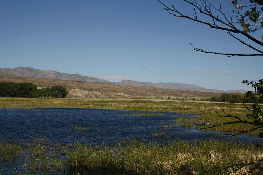
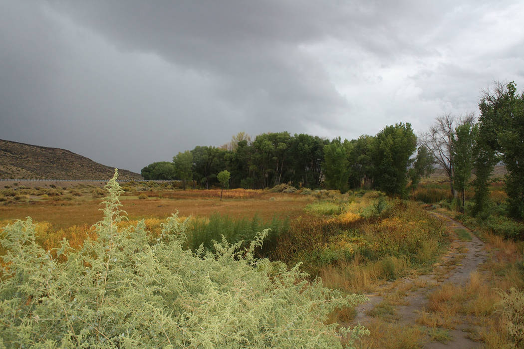
Pahranagat lies along U.S. Highway 93 in Lincoln County, about 90 miles north of Las Vegas just south of the ranching community of Alamo. It encompasses 5,382 acres of diverse habitats, including lakes, marshes, meadows, riparian areas and open desert, all of which makes it a bird watcher’s paradise.
There are three large bodies of water here: Upper Lake, Middle Marsh and Lower Lake, fed by Ash and Crystal springs, which flow in from the north. With about 580 acres of water and a healthy habitat, it is the year-round home to many birds and other wildlife, as well as a busy resting and refueling place for thousands of migrating birds in the spring and fall. The refuge is a critical part of the Pacific Flyway that stretches from Alaska and Canada to Mexico.
I can’t guarantee the sandhill flash mob will appear at the same time you are there, but a visit in the next few weeks or so should give you a chance. And if you keep your eyes open, you’ll almost certainly see something interesting. There have been more than 300 species of birds recorded here, including Canada geese, mallards, great blue herons, northern harriers, American kestrels, killdeer, great horned owls, loggerhead shrikes, red-winged blackbirds, horned larks and verdant.
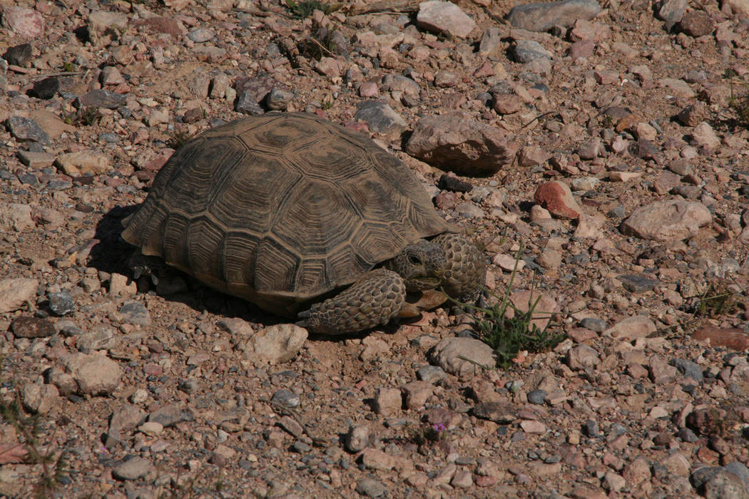
Other wildlife in the park includes desert tortoises, coyotes, mule deer, kit foxes, bobcats, mountain lions and beavers. Pahranagat also boasts historic sites. This area was home to the Paiute people, and there are many rock art sites containing both petroglyphs and pictographs.
“Pahranagat” is a Paiute name meaning “valley of shining water.”
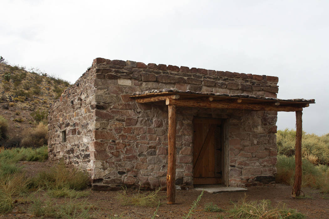
On your way to the visitor center, stop and take a quick look around Walden House (known as the Petroglyph Cabin), built by pioneers around 1864. This stone house could possibly be one of the oldest standing structures in Lincoln County. It has some unusual carvings on the stones that appear to be old cattle brands. Look to the left of the front door and you will see a carving of a face, a replica of one that was stolen from the house in 2001.
The visitor center was built in 2015 and features interactive exhibits, a 15-minute movie about the refuge and some short accessible nature trails. Children can pick up a junior refuge ranger activity book to fill out while they explore the park. If they complete the activities, they will receive a badge and refuge pin.
There are more than 9 miles of trails in the refuge; some are for foot traffic only while others are shared with mountain bikes. Download a trail map before you arrive or pick one up at the visitor center.
The refuge is close enough for a day trip, but camping is a wonderful option. On Upper Pahranagat Lake there are 15 free campsites available on a first-come, first-served basis. There is a picnic table at each site, and fires are allowed in grills and in firepits.
Be sure to bring binoculars and a field guide for birding, along with hiking boots or sneakers. Bring your own food and water; there is a small store in Alamo that has gas and basic food and drink supplies.
The refuge is at an elevation of 3,350 feet, so expect temperatures to be about 5-10 degrees cooler than in Boulder City.
The refuge is open 24 hours a day year-round. The visitor center is usually open Thursdays through Sundays, but it’s wise to call before your visit as there are seasonal changes. The Middle Marsh and Lower Lake have been temporarily closed; again, it’s wise to call before you plan to visit these areas.
For more information , call 775-725-3417, or visit the website www.fws.gov/refuge/Pahranagat.
Many of Deborah Wall’s columns have been compiled into books about hiking in the Southwest. She is also the author of “Great Hikes, a Cerca Country Guide” and a co-author of the book “Access For All, Seeing the Southwest With Limited Mobility.” Wall can be reached at Deborabus@aol.com.
Directions
From Boulder City, From Boulder City, take U.S. Highway 93/U.S. Highway 95 west and continue on U.S. 95 until it intersects with Interstate 15. Take I-15 north for 21 miles, exiting onto U.S. 93, the Great Basin Highway. Drive north on U.S. 93 for 69 miles and go left to the signed refuge headquarters or a few miles farther north on U.S. 93 to access the refuge's Upper Lake.


