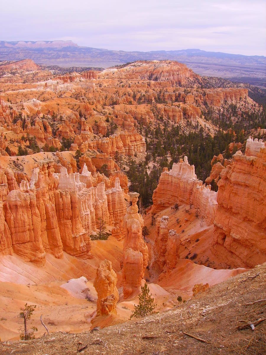
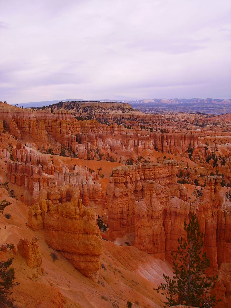
Colorful hoodoos inspire Bryce’s visitors
“It’s a hell of a place to lose a cow,” Ebenezer Bryce apparently said in the late 1880s about the ungodly terrain here. Whether he had personally misplaced a bovine, or was just humorously theorizing, it’s still pretty funny as Bryce Canyon National Park in southern Utah is an extraordinary mazelike place of steep terrain filled with hoodoos, spires, pinnacles, nooks and cow-sized crannies.
Bryce was one of the early settlers in the area, arriving in 1875. Helping with a local water diversion project, Bryce built a rough road into one of the amphitheaters for ease of getting timber needed for the job. From then on people referred to that area as Bryce’s canyon. Although he and his family moved on to Arizona in 1880, the name stuck.
The 35,835-acre national park, established in 1928, lies on the eastern rim of the Paunsaugunt Plateau. While it is named Bryce Canyon, it’s actually a collection of about a dozen natural limestone amphitheaters. Filled with multicolored formations, mostly hoodoos, the landscape makes it a joy to wander as they seem to change shape and color at every bend and curve.
These fantastical shapes are still being formed from frost wedging, an ongoing process. More than 200 days of the year here, temperatures fluctuate greatly. Fissures in the limestone fill with water from melting snow and then it freezes and expands, which causes the rock to split and flake and over time causing a new shaped hoodoo.
To learn more about the geologic wonders in the park, take part in one of its outdoor programs running this summer. While the park has canceled some regular events and programs due to COVID-19, others are still being offered daily. Check out the Hoodoo Geology Talk at Sunset Point at 11 a.m. or 2 p.m. or the Grand Staircase Talk at Yovimpa Point at 12:30 or 1:30 p.m., the latter with additional times of 2:30 and 3:30 p.m. Thursday through Monday. These programs last 20 minutes each. Social distancing will be in place and enforced by rangers. Please wear a mask.
Whether you are hiking the trails down into the amphitheaters, taking a scenic drive or enjoying the scenic overlooks, the main reason people flock here – those who remain after sunset — can enjoy another reward: some of the best stargazing in the country. An almost total absence of stray light makes it an ideal place to stargaze.
On moonless nights here, such as 2020’s July 20, Aug. 18 and Oct. 16, it might be possible to see about 7,500 stars. Of course, we might give that up to be in the park during a full moon, which is incredible in its own right, as the hoodoos take on an interesting glow when the moon illuminates the canyon. The next few full moons will be Aug. 3, Sept. 2 and Oct. 1.
Besides the natural beauty of Bryce, a big draw this time of year is that temperatures are usually ideal for outdoor activities. The park’s elevation ranges from about 8,000 feet to 9,100 feet. Daily high temperatures in July are in the low 80s, with lows dipping down to the low 50s. Afternoon thunderstorms are common, but they usually don’t last long.
Wildlife in the park include deer, elk, ringtail cats, mountain lions, bobcats, gray foxes, jackrabbits and cottontails. Also look at the overlooks for peregrine falcons and golden eagles soaring above, and in the forested areas and sagebrush look for Clark’s nutcrackers, Steller’s jays and wild turkeys.
Currently, all roads, trails and viewpoints are open, including backcountry trails. The visitor center and the bookstore are open daily (with limited occupancy), from 8 a.m. to 8 p.m., yet the theater is closed.
Camping is the best way to go in this region and in the park itself. Sunset Campground is open, by reservation at https://www.recreation.gov. North Campground is expected to open later this month after a paving project is finished. It has 99 sites and is available on a first-come, first-served basis.
A variety of other camping choices are available nearby, including at Ruby’s Inn, located 1 mile from the entrance of the park, which has an excellent recreational vehicle park and campground. For information, visit https://www.rubysinn.com.
Cell service is spotty at best. Restrooms are open but be sure to bring your own wipes, hand sanitizer and face protection. Park only in designated parking areas, maintain social distancing and avoid crowded overlooks.
Always check the park’s website before setting out to the park as things can change on a daily basis. For up-to-date information on the park, call 435-834-5322 or visit https://www.nps.gov/brca.
Many of Deborah Wall’s columns have been compiled into books about hiking in the Southwest. She is also the author of “Great Hikes, a Cerca Country Guide” and a co-author of the book “Access For All, Seeing the Southwest With Limited Mobility.” Wall can be reached at Deborabus@aol.com.
Directions:
Take U.S. Highway 93 north for about 25 miles until it merges with Interstate 15. Travel north about 205 miles to Utah State Route 20. Continue for 20 miles to U.S. Highway 89 and go south for 16 miles to Utah State Route 12. Follow that to Utah State Route 63 and the entrance to the park.


