Waterfall reliably beautiful year-round
The 124-mile Scenic Byway 12 in Utah, an All-American Road, is one of the most exceptional scenic byways in the Southwest. The drive takes you through canyons, valleys and plateaus within an extraordinary landscape ranging in elevation from 4,000 to 9,000 feet, a feast for the eyes the entire trip. This route accesses archaeological, historic and cultural sites, but it is especially rich in opportunities to simply enjoy the outdoors.
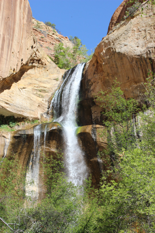
Without getting too far off the beaten path, one of the best is a hike to Lower Calf Creek Falls. Lying in the Grand Staircase-Escalante National Monument, this 126-foot cataract, plunging into a large pool, is one of the most visually stunning waterfalls in the Southwest. Perhaps a few others can outdo it at certain times, after a big snow melt or heavy rain, but reliable Calf Creek puts on a good show every day.
It’s a relatively easy trek to get there — a 6-mile round trip on a nearly flat trail. It is a safe hike for children if they can handle the distance.
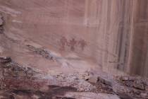
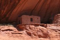
The trail passes through a picturesque canyon of orange and red Navajo sandstone, where Calf Creek runs intermittently. Along the way you will see two prehistoric granaries and a large pictograph panel that seems to depict warriors. Be sure to bring binoculars to get a close look at the latter for it is on a high wall and not close to the trail.
The trailhead is in the Calf Creek Recreation Area’s campground. The elevation here is about 5,400 feet. Hiking weather is usually ideal in May, but by June expect temperatures in the 80s or 90s. By then it is often too warm to hike if you don’t get started first thing in the morning. However, the large pool beneath the waterfall makes a great place to cool off. Also on the return to the trailhead, the creek is a good place to cool yourself or wet down your clothes.
Before starting the hike, be sure to grab an interpretive brochure from the campground hosts or at the trailhead. This will help you identify the highlights along the trail.
In the last half-mile or mile the vegetation becomes very dense with mature deciduous trees, and you will notice a big drop in temperature. Check out the creek for beaver dams. On one of my hikes here in May, I even came upon two mature wild turkeys with two poults.
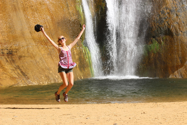
Because of the vegetation you will hear the waterfall before you see it. The canyon surrounding the waterfall is home to maidenhair ferns, scarlet monkey flowers and alcove columbines. Feel free to wade, swim or even stand under the waterfall, or just sit on the sandy edge of the pool and rejoice in the cooling mist that nature has provided.
Calf Creek Campground has 14 campsites and is managed by the BLM. The best way to book a site here is by contacting the Escalante Field Station, 755 W. Main St., Escalante, Utah, 435-826-5600 or www.ut.blm.gov/monument/.
Many of Deborah Wall’s columns have been compiled in the book “Base Camp Las Vegas, Hiking the Southwestern States.” She is also the author of “Great Hikes, a Cerca Country Guide” and a co-author of the newly released book “Access For All, Seeing the Southwest With Limited Mobility.” Wall can be reached at Deborabus@aol.com.
Directions: From Boulder City take US 93/95 about 25 miles to Las Vegas. Take I-15 north 125 miles into Utah and take the exit for Hurricane/Zion National Park. Follow Utah Route 9 for 57 miles through Zion National Park and turn left onto U.S. 89 north. Follow for 44 miles to a right onto Utah Route 12. Follow for 74.5 miles and go left into the BLM Calf Creek Recreation Area and parking area. This will be about 14.5 miles northeast of the town of Escalante.

