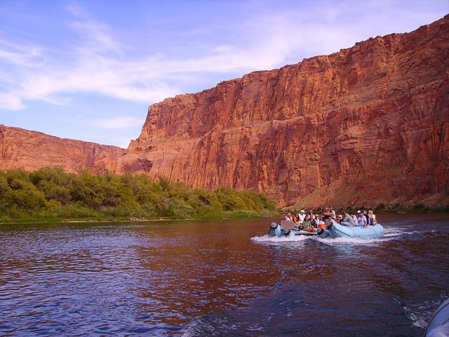
Stunning scenery: Raft trips through Glen Canyon let you get up close with flora, fauna
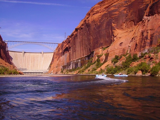
Glen Canyon, Arizona, contains one of the few stretches of river whose beauty rivals that of the Grand Canyon farther down the Colorado River. However, it is much more easily experienced, through smooth-water raft trips launching directly below Glen Canyon Dam and traveling downstream about 15 miles to Lee’s Ferry. Along the way you will be treated to a close-up view of Glen Canyon Dam, stunning scenery, plenty of wildlife, and prehistoric and historic sites.
The half-day trips start in Page, Arizona, at an elevation of about 4,000 feet, so you will usually find the temperatures on a given day about 10 degrees cooler than in the Las Vegas area. It will still be hot on the water and there will be hardly any shade, so be sure to wear protection from the sun such as a hat, ultraviolet long sleeves/pants and a bathing suit if you care to swim. Bring sunblock, sunglasses and wear water shoes if you have them or sneakers. Flip flops are not advised.
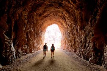
In Page, visitors board a motor coach or van and head through a security checkpoint and a 2-mile-long tunnel that comes out at the water directly below the dam. This access road is not open to the general public in private vehicles.
Visitors then transfer to a motorized pontoon raft. I think the best seats are on an outer pontoon, with your legs straddling it.
Once you begin heading downstream your river guide will point out all the highlights along the way. On the towering orange and red-colored cliffs you will see small waterfalls, natural alcoves, hanging gardens of wildflowers and plenty of birds. On my last trip I saw bald eagles, great blue herons and ospreys.
A highlight of the voyage is making the 270-degree turn around Horseshoe Bend. If you look carefully at the surrounding cliffs, you might see people photographing the bend from an overlook 1,200 feet above you. Horseshoe Bend is one of the region’s favorite subjects for photography.
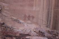
Once you reach about the halfway point of the trip the guide will stop on a beach where guests can take a swim in the chilly water, which ranges from approximately 50-60 degrees, and take a short trail to see some American Indian petroglyphs.
The rafting voyage ends at Lee’s Ferry. Just before you get off the river you will be able to see the original ferry site. In its time, the ferry was the sole link between settlements in Utah and northern Arizona, and gave its name to a cowboy song about yearning for home and old friends. Used from the 1870s until 1928, it was no longer needed once the Navajo Bridge was built across the river.
After you disembark the raft you will have a few minutes to walk around and use the bathroom before you board the waiting transportation back to Page.
Colorado River Discovery offers half-day and full-day excursions. The half-day trip makes a U-turn at Horseshoe Bend, while the full-day trip continues on to Lee’s Ferry.
This time of year, participants on the half-day raft trip meet at the Colorado River Discovery Welcome Center, (the rafting headquarters) at 7 a.m. or 12:30 p.m. and will arrive back in Page at approximately 11:30 a.m. or 5 p.m.
From Oct. 1 through Nov. 30, only one trip is scheduled daily, assembling at 10:30 a.m. and returning to Page by about 3:30 p.m. Costs are $86 for adults and $76 for children 4-12. No guests younger than 4 are allowed. There is also a $6 “river use fee” per person.
Full-day raft excursions depart at 10 a.m., return to Page about 4 p.m. and cost $112 for adults and $102 for children 4-12. This trip is approximately six hours long and includes water, lemonade and a bag lunch.
Because of Homeland Security policies, for half-day trips you may only bring clear plastic, vinyl or PVC bags on the float trip. Wallets and cameras can be brought on board but no purses, coolers, backpacks, fanny packs, luggage, computer or camera bags.
For reservations or further information, contact Colorado River Discovery, 130 6th Avenue, Page, Arizona, 888-522-6644 or 928-645-9175 or www.raftthecanyon.com.
Many of Deborah Wall’s columns have been compiled in the book “Base Camp Las Vegas, Hiking the Southwestern States.” She is also the author of “Great Hikes, a Cerca Country Guide” and a co-author of the book “Access For All, Seeing the Southwest With Limited Mobility.” Wall can be reached at Deborabus@aol.com.
Directions: From Boulder City take Highway U.S. 93/95 north for about 20 miles. Merge right to take Interstate 15 north and drive for about 135 miles (passing through Arizona) to Utah Route 9 (Exit 16-Hurricane/Zion National Park). Drive 9 miles and go right onto Utah Route 59 east. This 61-mile paved road turns into Route 389 when you enter Arizona, and then into U.S. Route 89A north when turning left in Fredonia, Arizona, just a few miles south of Kanab, Utah. From Kanab take U.S. 89 east for about 70 miles to Lake Powell and Page, Arizona.

