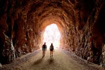
Slot canyons offer stunning views


While there are hundreds of stunning slot canyons in our region, most of them are difficult to reach and many require technical skills to explore them. Two of the best, however — tops on my list for being visually stimulating — are pretty easy to access.
Both are on the Navajo Indian Reservation just outside of Page, Arizona. Late spring is an optimal time to go as the weather isn’t hot yet and the summer tourist season hasn’t started yet.
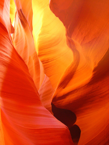
The slots lie a few miles apart along Antelope Creek, a usually dry wash that drains into Lake Powell. Upper Antelope Canyon is known to the Navajo as Tse bighanilini, meaning “the place where water runs through rocks” and Lower Antelope Canyon is called Hasdeztwasi or “Spiral Rock Arches.”
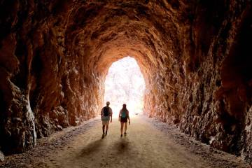
You will need to have an authorized guide or outfitter, available either in the town of Page or at the trail heads on Antelope Creek. Be advised these are tremendously popular tours so you won’t have solitude, but the natural beauty and photo opportunities of these canyons are well worth that minor shortcoming.
The majority of people visit one or the other of the slots but some tour companies offer a package deal for seeing both. If you have enough time and energy to do both slots, I would recommend it as each provides a different experience.
Upper Antelope Canyon is best for those with children or for people who don’t want to climb up and down stairs. To start a tour here your guide will load you in an open-air vehicle or other transportation and drive a few miles up the wash to the entrance.
Once inside the canyon, the walking is easy, though on soft sand. The pinks, reds and oranges of the corkscrewing sandstone walls are amazing to see. The sand was originally laid down in graceful waves, and though the sand long ago turned to stone, these waves are still visible and beautiful just worn from water.
While the canyon is only about 200 yards deep, a group awestruck by the formations and, of course, photographing them, will take some time to pass all the way in and out.
Because the canyons are so deep and narrow, the best light for photography is at midday through September, so plan your trip for that time if you can.
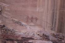
The Navajo consider these canyons to be spiritual places and most guides will give you lots of details on their culture. Some even will play the flute for visitors while inside the canyon.
Lower Antelope Canyon is a bit different because you need to negotiate stairs throughout. This canyon has excellent formations as well, but because of the different natural light in this one, the colors appear to be more red, pink and purple.
As with all slot canyons, these are extremely dangerous places to be during and after heavy rains. Water funnels down through them, in powerful flows bearing much mud and debris. In 1997, 11 tourists visiting lower Antelope Canyon were killed in such a flash flood. Precautions established since then should keep you safe, as long as you heed them.
For tour guides and more information on visiting both canyons contact 928-645-9496 or www.visitpagelakepowell.com/.
Many of Deborah Wall’s columns have been compiled in the book “Base Camp Las Vegas, Hiking the Southwestern States.” She is also the author of “Great Hikes, a Cerca Country Guide” and a co-author of the newly released book “Access For All, Seeing the Southwest With Limited Mobility.” Wall can be reached at Deborabus@aol.com.
Directions
From Boulder City take U.S. Highway 93/95 about 25 miles to Las Vegas. Merge right onto Interstate 15 north 125 miles to Utah Route 9 (Exit 16, Hurricane/Zion National Park). Drive 9 miles and go right onto Utah Route 59 east. This 61-mile paved road turns into Route 389 when you enter Arizona, and then into U.S. Route 89A north when turning left in Fredonia, Arizona, just a few miles south of Kanab, Utah. From Kanab, drive east on U.S. Route 89 for about 70 miles to the Glen Canyon Bridge and Page.