Petroglyphs highlight Lincoln County sites


Lincoln County, Nevada, our nearest neighboring county to the north, is rich in sites where you can see unspoiled petroglyphs, the mysterious rock carvings that have graced cliffs and boulders since prehistoric times. Two of my favorite sites in that area are the White River Narrows Archaeological District and the Mount Irish Rock Art and Archaeological District, both located off State Route 318, north of Alamo and Hiko.
You can visit both of these sites in a single long day, but you’ll need a high clearance vehicle with good off-road tires or a good mountain bike for the access roads. When I take friends to visit these sites, I start with the White River Narrows first as it is the farthest away. Then I work my way back south 20 miles or so to the Mount Irish area.
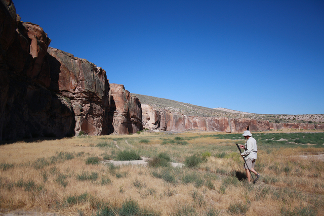
The rhyolite cliffs you’ll encounter as you drive to the White River site are stunning in their own right but the highlight is at the terminus of the gravel drive where you’ll find the Amphitheater. Here, the reddish cliff walls form a crescent shape above the grassy meadow below.
Park at the self-serve register box and pick up a fact sheet on the sites here, then just head a hundred yards or so over to the cliffs on your left. The grass here grows tall this time of year so be especially careful where you walk. I met a rattlesnake here once, and the daytime weather is about right for him, or his family, to be out for a crawl. The elevation here is around 4,600 feet so expect temperatures some 10 degrees cooler than Las Vegas.
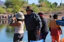
You will be hard-pressed to not find this an impressive site. All along the cliff walls you will find petroglyphs. Most of them are prehistoric carvings presumably done by American Indians, but you’ll also find some interesting glyphs carved by pioneers of European descent.
After you tour the Amphitheater and start back to the main road, after traveling about 1 mile, turn left onto a small spur road to the cliff face.
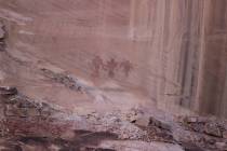
Here you’ll find an unusual petroglyph, a panel called a “calendar fence.” While no one knows for sure, the lines suggest a memorial to one person’s life, as if somebody had carved one line into the cliff every year.
Returning to State Route 318 drive south for about 20 miles. About 1 mile south of the well-marked Key Pittman Wildlife Management Area, look for the gravel road on your right. It is marked with a Bureau of Land Management sign and a gate. Drive west for about 9 miles to the Mount Irish area. Scientists, who have studied the area’s chipped and ground stone, rock shelters and petroglyphs, conclude the area was occupied from 1000 B.C. to the 1860s.
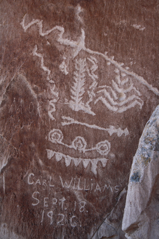
Most of the petroglyphs are well-preserved, and there is a lot of variety. You’ll see rock art of deer, bighorn sheep and anthropomorphs (figures that resemble human bodies.) There are three different concentrations of petroglyphs, so be sure to explore.
Never climb on, touch or disturb any rock art or other archaeological sites you come across. To get a good close up-view of inconveniently placed art, bring binoculars.
For more information on these and other rock art sites in Lincoln County go to www.lincolncountynevada.com/, choose the menu option “Exploring” and then drop down to “Rocking.” This website also will help you find a place to camp, lodging, dining and other services in the area.
Many of Deborah Wall’s columns have been compiled in the book “Base Camp Las Vegas, Hiking the Southwestern States.” She is also the author of “Great Hikes, a Cerca Country Guide” and a co-author of the newly released book “Access For All, Seeing the Southwest With Limited Mobility.” Wall can be reached at Deborabus@aol.com.