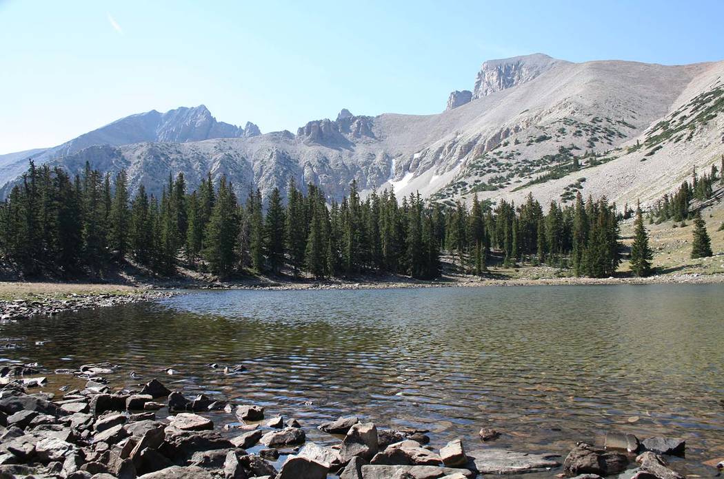
Alpine Lakes Loop Trail is one of the best all-around hikes in Great Basin National Park, especially if you’re hiking with people of varying ages and abilities. The loop trail features fantastic views of Wheeler Peak, 13,063 feet in elevation and the second (or first depending on how Boundary Peak at 13,147 feet is classified) highest in Nevada. The hike also passes by two pretty mountain lakes.
Though in a somewhat remote part of Nevada, Great Basin offers wonderful summer weather, and enough attractions to extend the visit another few days if you have the time. If you go soon, you can enjoy some wildflowers and see a variety of butterflies; there is always a good chance of seeing other wildlife as well.
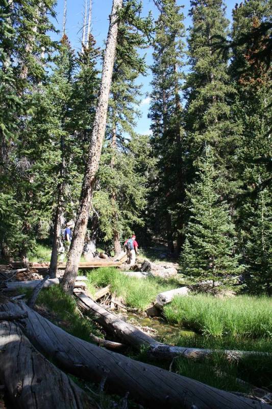
From the Bristlecone parking area, located just before the Wheeler Peak Campground and at an elevation of 9,988 feet, you will find the trailhead. Follow the obvious trail for 0.2 miles and go right onto the signed Alpine Lakes Loop Trail. Here you walk through a forest of Englemann spruce, aspen and limber pine, flanked by open meadows. Keep an eye out for marmots, mule deer and beaver, and in early August on this trail you might also be treated to an abundance of those butterflies.
The 2.7-mile loop has an elevation gain of only 600 feet, so it won’t be very strenuous in distance and elevation. Yet, because of the high altitude, you might find it more tiring than equivalent trails at lower elevations. Altitude sickness is always a concern in the higher reaches of the park, so be on the alert for signs in anyone hiking with you.
You will travel by two sub-alpine lakes, Stella and Teresa. Both lakes are primarily filled with snowmelt, so by September, they can be low, depending on summer rainfall and other weather. Each lake occupies a glacial cirque — a type of basin named for its shape —with steep banks.
A big bonus in any trip to Great Basin National Park is the opportunity to visit Lehman Caves, which despite the name is actually one large cavern, complete with impressive stalactites and other underground wonders. The ranger-led tours fill up fast, so be sure to make reservations before leaving home.
The park also offers astronomy programs through Labor Day on Tuesday, Thursday and Saturday nights. In September and October, the schedule shifts to Saturday night only.
For more information on these programs and camping in the park contact the park at 775-234-7331, or www.nps.gov/grba.
If you are free Aug. 9, please stop by the Clark County Library, 1401 E. Flamingo Road, for the launch of my new book, “Base Camp Las Vegas, 101 hikes in the Southwest.” This casual occasion starts at 5 p.m., but come when you can. I love to talk personally with fellow outdoor people and hear your stories.
I will have the new book on hand for purchase, and if you want, I will sign one for you.
If possible, though it’s not required, shoot me an email that you will be coming, so we are sure we have enough food for everyone, and so that I can make it a point to meet you personally: Deborabus@aol.com.
Many of Deborah Wall’s columns have been compiled into books about hiking in the Southwest. She is also the author of “Great Hikes, a Cerca Country Guide” and a co-author of the book “Access For All, Seeing the Southwest With Limited Mobility.” Wall can be reached at Deborabus@aol.com.
Directions
From Boulder City take U.S. Highway 93/95 north about 20 miles and merge onto Interstate 15 north. Follow for 21 miles, exiting to U.S. 93 north, the Great Basin Highway. Follow for 234 miles and turn right onto U.S. Highway 50. Drive about 30 miles and go right onto Nevada Highway 487. Go about 5 miles into Baker and take a right onto State Route 488, the 5-mile access road into Great Basin National Park. Go right onto the 12-mile Wheeler Peak Scenic Drive; at the end of this road are Wheeler Peak Campground and trailhead.