This is a great time of year to head up to the Spring Mountains National Recreation Area — what we locals call Mount Charleston. You will experience crisp early fall temperatures and maybe a good fall foliage show in the surrounding mountains.
One of the best choices might be Fletcher Canyon, a side branch off the larger Kyle Canyon. This is a moderately strenuous hike with an 880-foot elevation gain overall, but it is suitable for most older children and adults, as long as they can handle a 3.5-mile round-trip hike.
The trailhead is at about 6,920 feet in elevation, so expect cooler temperatures than in Las Vegas, about 25 degrees, or even more on some days. Also the thinner air may make hiking seem more strenuous, so keep that in mind before you embark. The trail will take you through a thick evergreen forest, by a spring-fed creek and then a narrow slotlike canyon.
From the signed trailhead, head up the hill on obvious, wide trail. Here you will be in a ponderosa and pinyon pine forest with mountain mahogany, oak and manzanita. Follow the trail for about 1¾ miles as it meanders upstream, crossing the usually dry wash about three times. On your last crossing, you will come to a water-filled creek. After this the trail narrows for about 50 yards or so before dropping directly into the drainage, where you will head left, upstream.
If rain threatens, turn around here and return to the trailhead, saving the hike for another day. This area is subject to severe flash flooding and there is no safe high ground to be found. If it has rained here a couple of days or so prior to the hike, expect pools of water in the drainage and if you continue, you will have to get your feet wet.
From here on up, the wash will serve as your main trail although you will find a few worn paths that skirt obstacles, such as boulders and fallen trees.
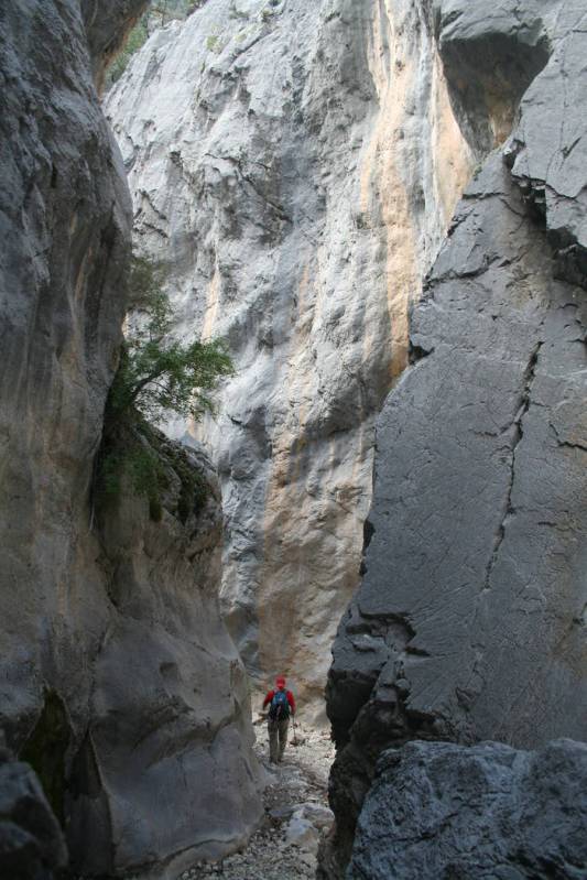
Once you reach the narrow area, you will find the canyon walls, which I estimate to rise about 100 feet, though the canyon here is so narrow you could almost touch both walls at once. This section is about 50 yards long and ends at a 10-foot boulder, which blocks further progress.
Or I should say, blocks easy progress. If you’re up for more work and adventure, presuming you have some basic bouldering skills, you can climb up the boulder, on the right side, into the upper canyon. Here, it forks and you can explore both forks with some rock scrambling.
Be aware that many hikers bring their dogs on this trail, and some don’t keep them on a leash. Also you will have to share the first part of the trail with equestrians. Snow often falls here starting in October, and typically remains through the winter, so head out soon.
Many of Deborah Wall’s columns have been compiled into books about hiking in the Southwest. She is also the author of “Great Hikes, a Cerca Country Guide” and a co-author of the book “Access For All, Seeing the Southwest With Limited Mobility.” Wall can be reached at Deborabus@aol.com.
Directions
From Boulder City take U.S. Highway 95 north about 40 miles. Go left on Kyle Canyon Road (Nevada Route 157) Drive 16.5 miles and turn left at the Spring Mountains Visitor Gateway. Pick up maps, books and trail information here. Continue west 1.1 miles to a parking pullout on left. The trailhead is directly across the street.